Property for Lease
Parcel of total surface 16,344 sq. meters
on the 20th km of the National Highway of Athens connecting Lamia and Thessaloniki (E75)
Municipality of KIFISSIA Municipal district of NEA ERYTHREA – ATTICA – GREECE – 14671
Basic Data of the Parcel
Facade: 65 meters in front of the Service Road. Side – Lane direction to Athens
Right Across: S/M MEGA AB VASILOPOULOS Delicatessen (EKALI Mega Store) , MEGA KOTSOVOLOS (DIXON’S acquisition) , TECHNOMAT Electrical Equipment
From the same side: with the Truck , Refuel and Rest Station on the 20th km of the National Highway (property of the National Road works Fund) and other fully operating business
Accessibility:
- Varibombi Highway Junction. For visitors/vehicles coming from the center of Athens and other suburbs that correspond to the National Highway Axis
- Agios Stefanos Highway Junction. For visitors/vehicles coming from the North and from the northern suburbs that correspond to the National Highway Axis
- Through the sub-route under the National Highway that connects Ekali with the Service Road with direction to Athens. (This underground road connects the 2 sides of Ekali, Nea Erythrea, and Kifissia that are separated from the E75 ) It is located 700 meters away of our property, and it is extremely convenient to the residents of the suburbs for quick access to our property.
Basic Data of the Parcel
Property’s Broader Neighborhood
It is situated on a prominent position in front of the Service Road and of course, is visible from the main National Highway (E75) . The specific highway and also the specific area consists mostly of commercial activities and companies.
This can be proved from the aerial photos showing the activity in the adjacent properties.

Basic Data of the Parcel
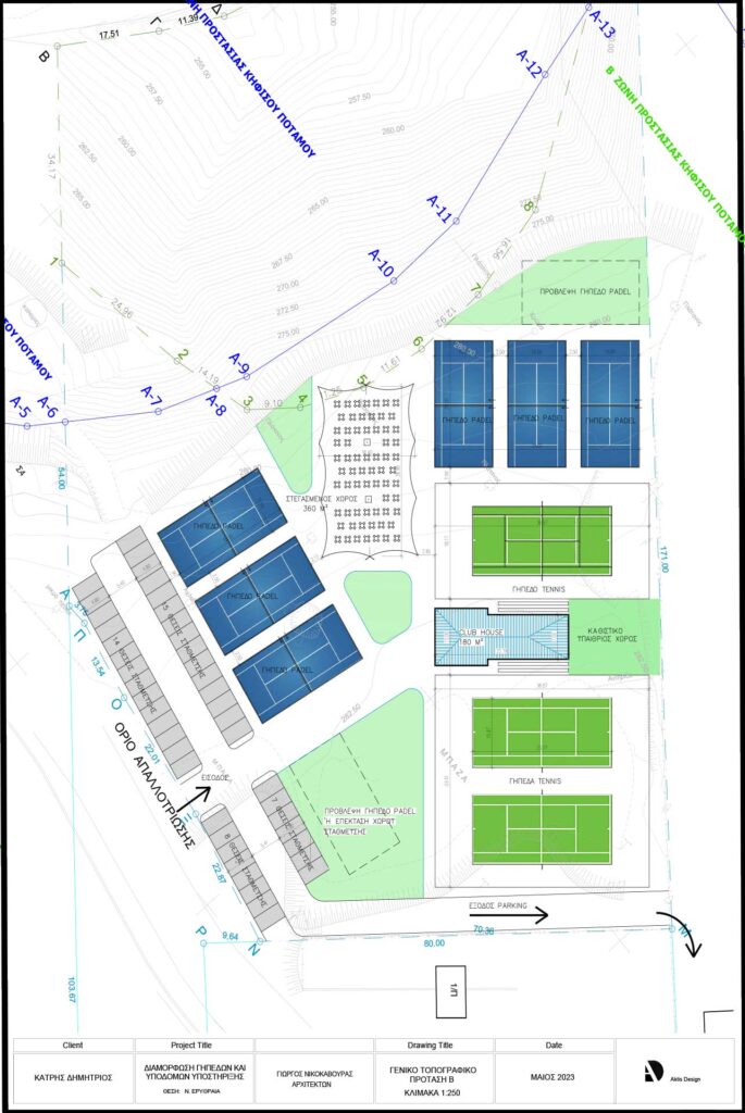
Depiction of the Property 16,344 sq. meters or 4 Acres and 400 sq.ft. boundaries. Indicated with the white line

Recent topography diagram

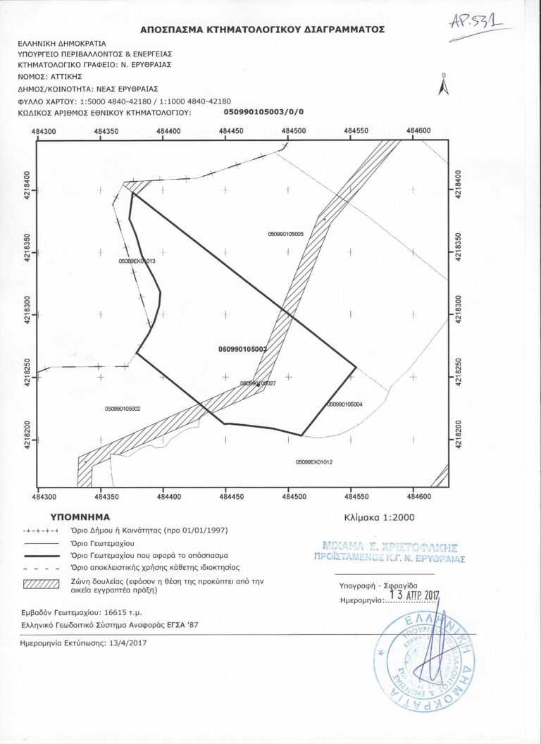
Cadastre
Quote of the Cadastre Diagram Excerpt – KAEK 050990105003 / 0 / 0 –
Ministry of Environment Excerpt from the declaration for the Forest Maps (our property is indicated as a Non-Forest Land)
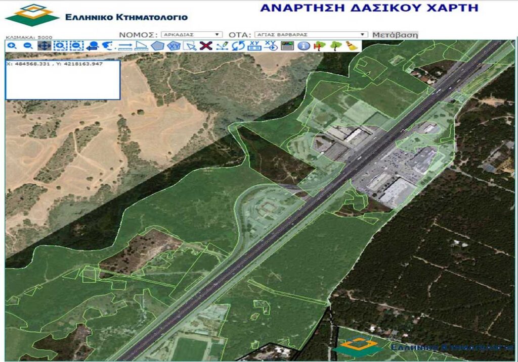
The not-shaded outline part with the shape of our property shows that the property is not a public forest protected by the state but a private, ready-to-be-used land.
The black stripes show that the land’s final result as NOT FOREST is locked and irrevocable.
Therefore the investor who wants to Buy or Lease will never have a dispute with the state.
The same statement of NOT FOREST is explicitly written on the Topography Diagram. With a declaration signed by the responsible engineer that signs the whole Topography Diagram.
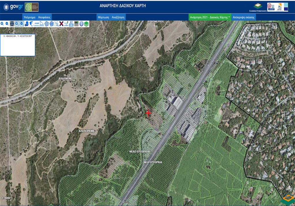
Current depiction of the Property (2025 Aerial photo)

Those characteristics make it a very interesting commercial land capable of establishing several kinds of different activities
with the most suitable as the amusement – entertainment activities and commercial retail sales inside the amusement park. Restaurant-Bar, swimming pool, sports activities, country club activities like golf courts or horse track and in general cultural building activities like Exhibition Center and gathering people facilities.
The suburb that our property belongs to and the surrounding suburbs are inhabited by medium and high-income residents.
From 1994 the urban planning law clearly allows for the area amusement-entertainment activities restaurants and cafe shops, water pools, sports activities, variety of entertainment activities and in general cultural buildings like exhibition centers and gathering of people spaces and similar activities according to the specific law.
Without excluding more common activities like warehousing both for containers or machinery, logistics, offices etc.
Suitable for
1. UNIVERSITY CAMPUS especially if combined with the adjacent property with the building.
2. Warehouses / LOGISTICS SITE
3. EXHIBITION CENTER for Commercial Activities
4. PARKING FOR TRUCKS AND LARGE CONTAINERS, Glamping Installations and personal amenities for the drivers i.e. WC and showers. Safe and Shadey Parking Lots Equipped with charging stations for e-trucks with photovoltaic panels and provision for Hydrogen Cells charging through those p-v installations
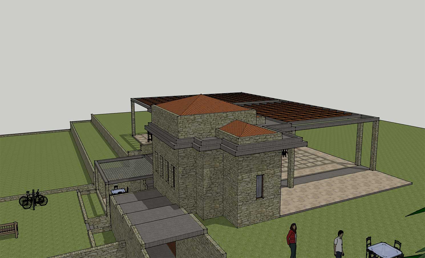
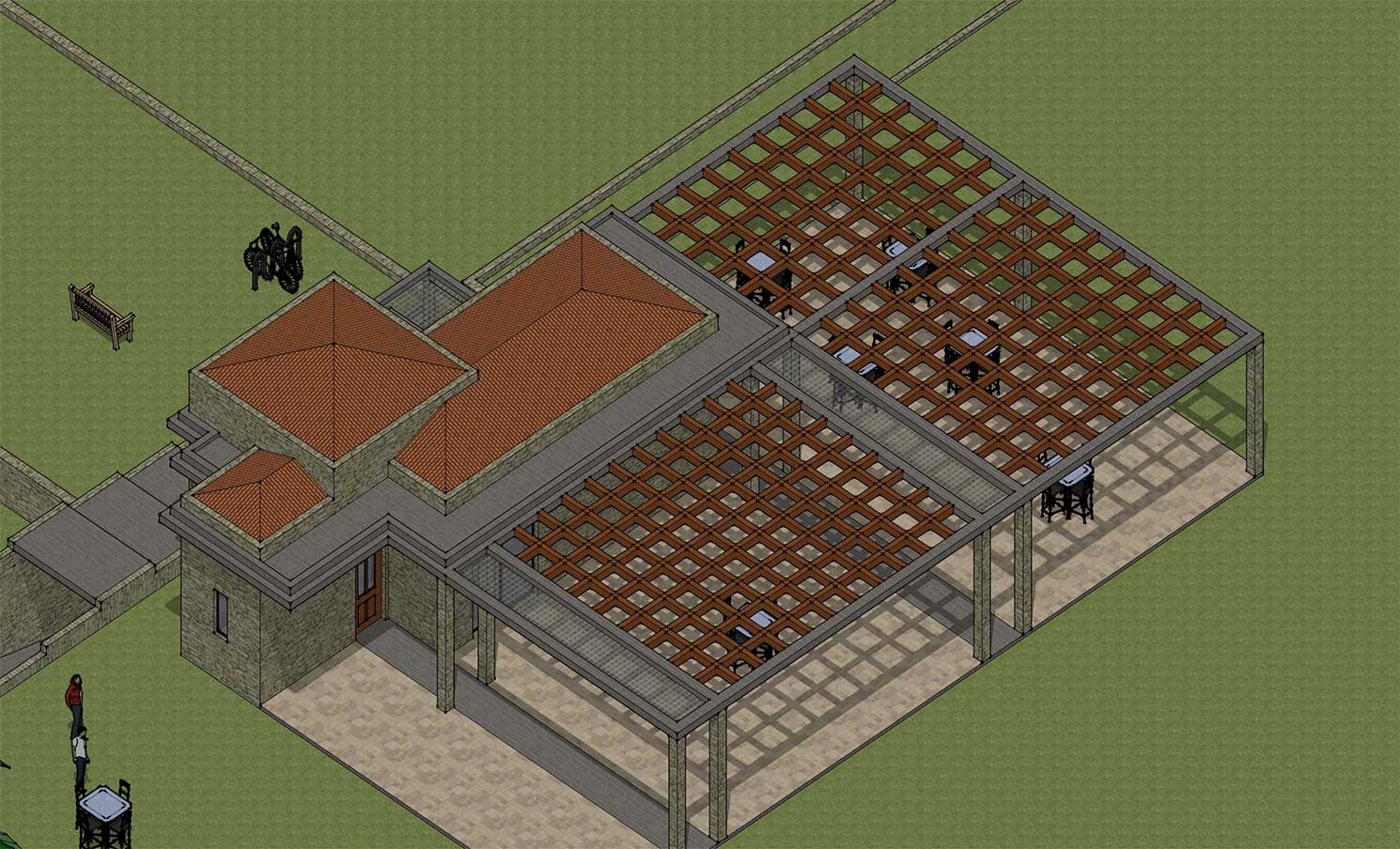
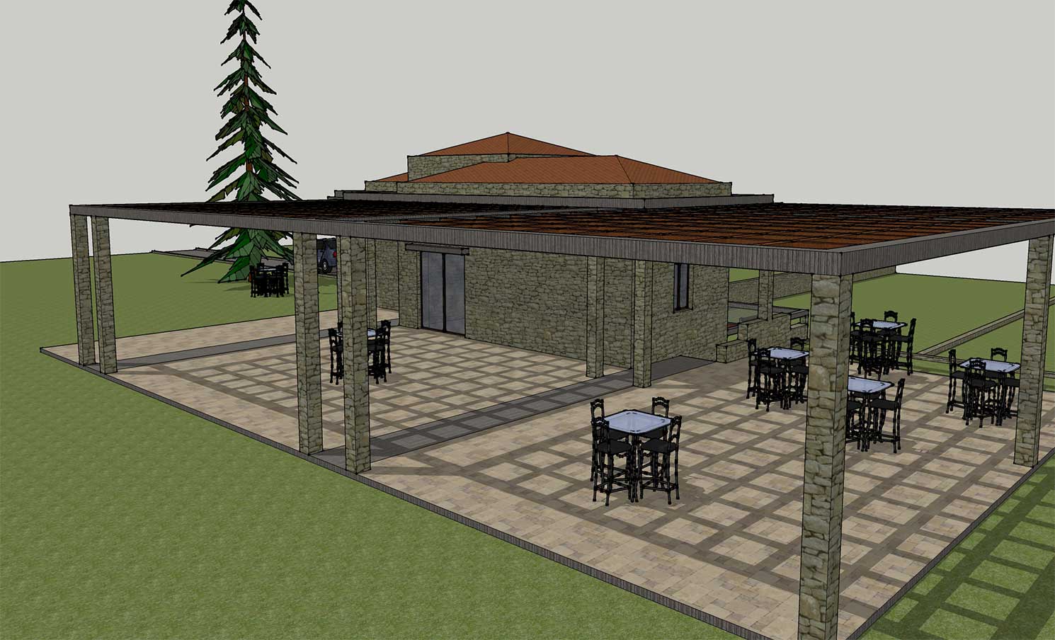
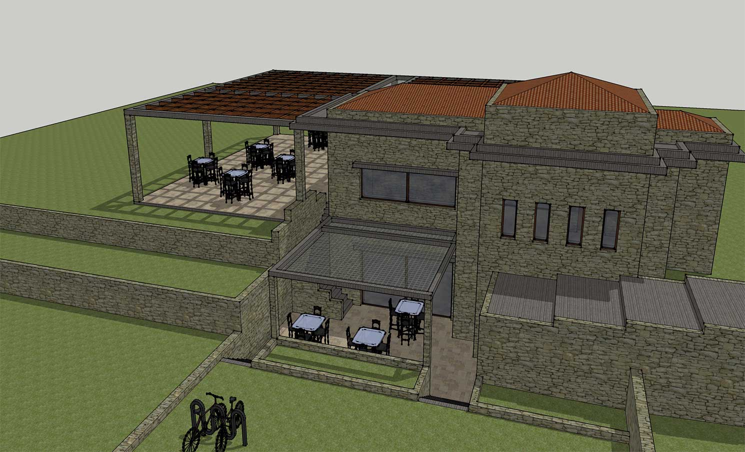
— 5. Bar – Restaurant / Lunch – Dinner
— 6. Short-Term REHAB – Health Center
— 7. Long-Term Pensioners Center
8. Family Entertainment Park
9. Sports activities
10. Horse Riding Installations
11. Corporate events / Reception Events / Gathering people activities
All the above combined with a multi-purpose construction that include a Bar and Restaurant.
Licence
Diagram (coverage factor) that accompanies the permission to Build

Approval for Building Constructions from the Urban planning Service (Validated/Authorised also from the local police dpt)
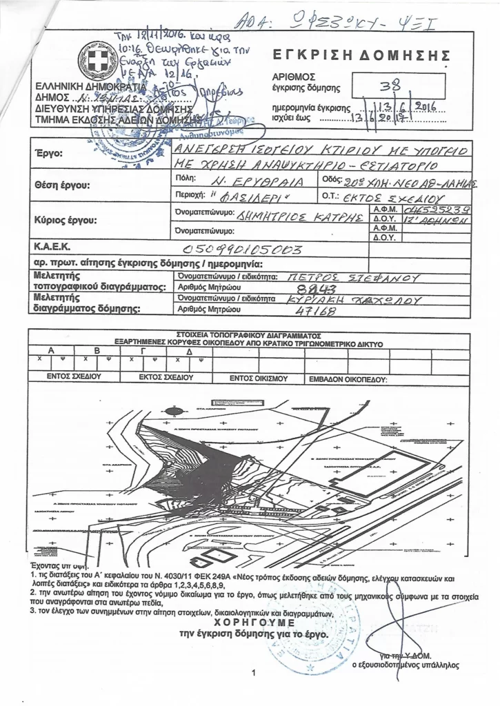
License to Build Issued from the Urban planning Service (POLEODOMIA) valid until 31-12-2025
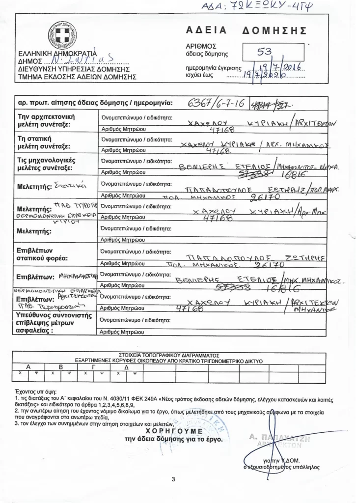
This particular licence is for establishing a private sports club